IoTplot is a cloud based platform for fleet management and IoT. The system allows end users to monitor vehicles, equipment, people, sensors, and other assets.
System capabilities:
- monitoring driver behavior, speeding, mileage, operating zones, operating times, OBD parameters, beacons;
- creating geofences, routes, drivers, trailers, and other system objects;
- integration with wireless sensors and custom inputs such as beacons, doors, panic buttons;
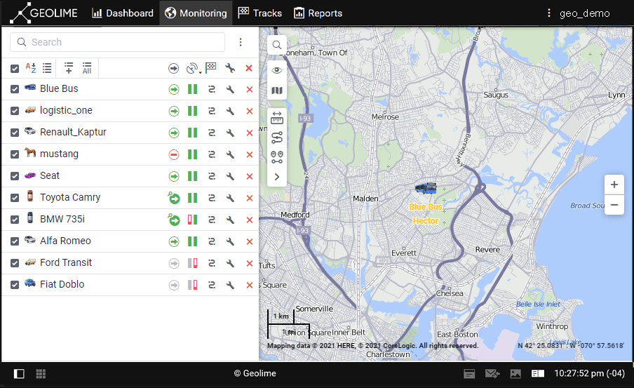
- tracking the location and movement of the units on the map;
- custom map integration (ArcGIS maps), Google Street View.
- monitoring changes in speed, fuel level, and other parameters;
- monitoring drivers, workers and trailers;
- monitoring temperature, humidity;
- generating reports (tables, charts, tracks on the map) based on the information received from IoTplot terminals;
- creating notifications based on certain criteria;
- and more..
Related articles
